New Altitude Photography & Aerial | Professional Drone Services in Virginia
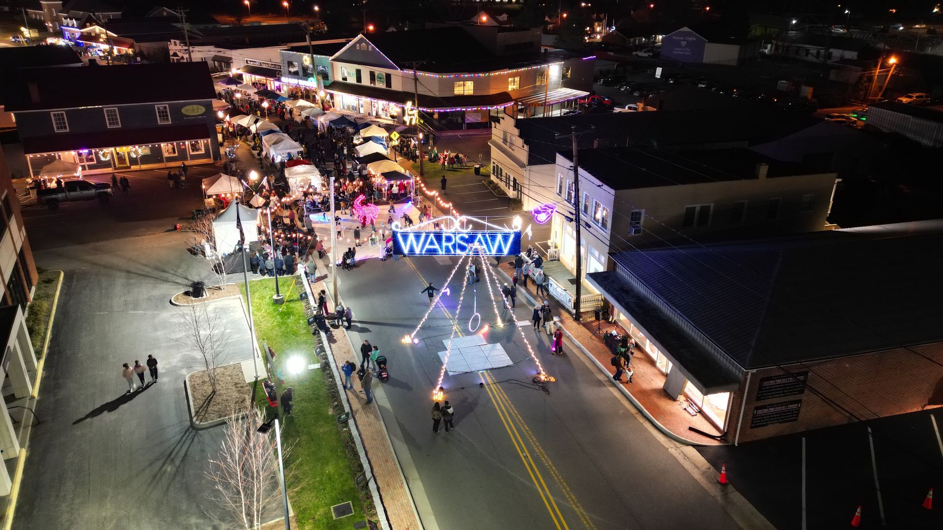
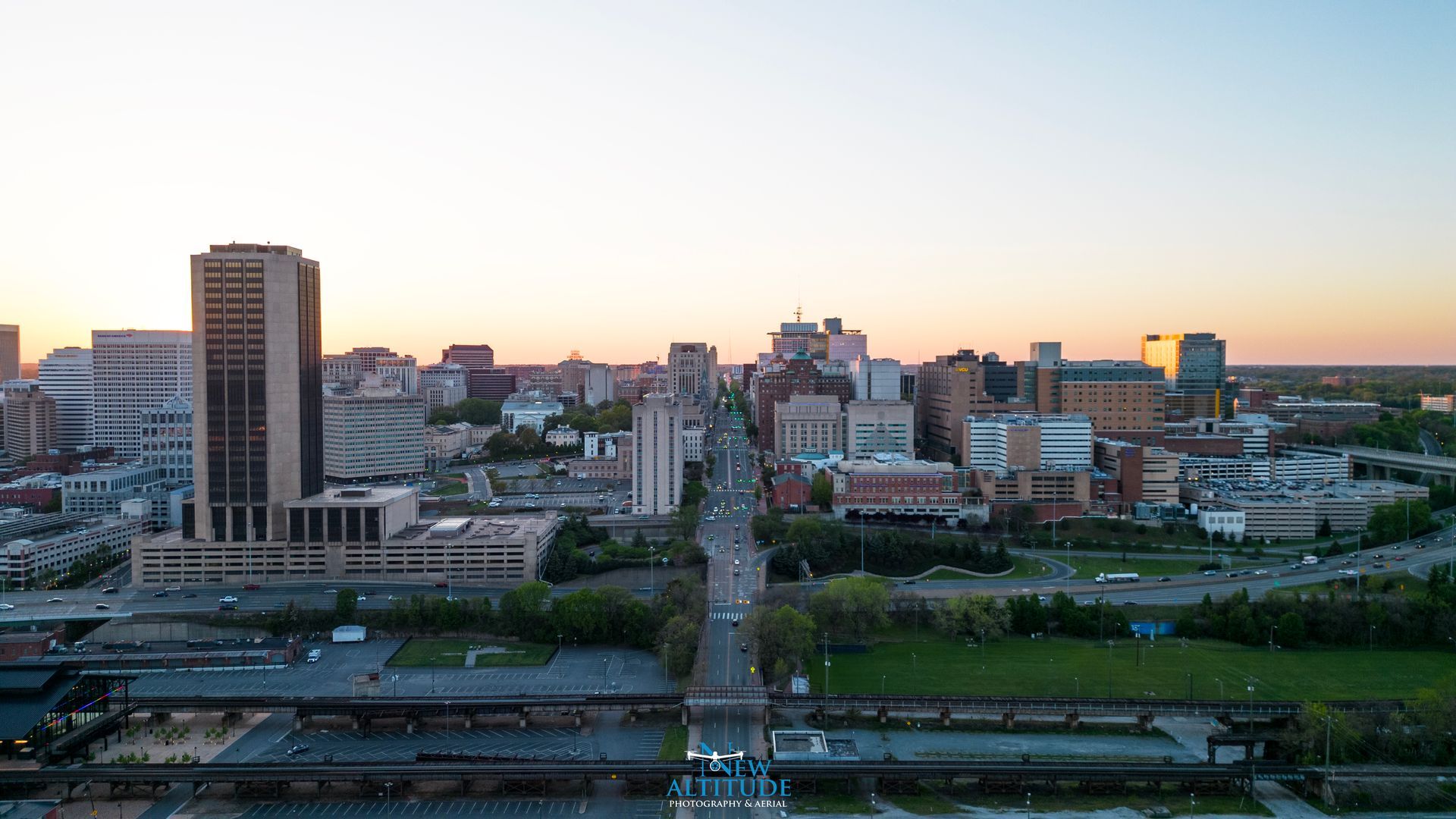
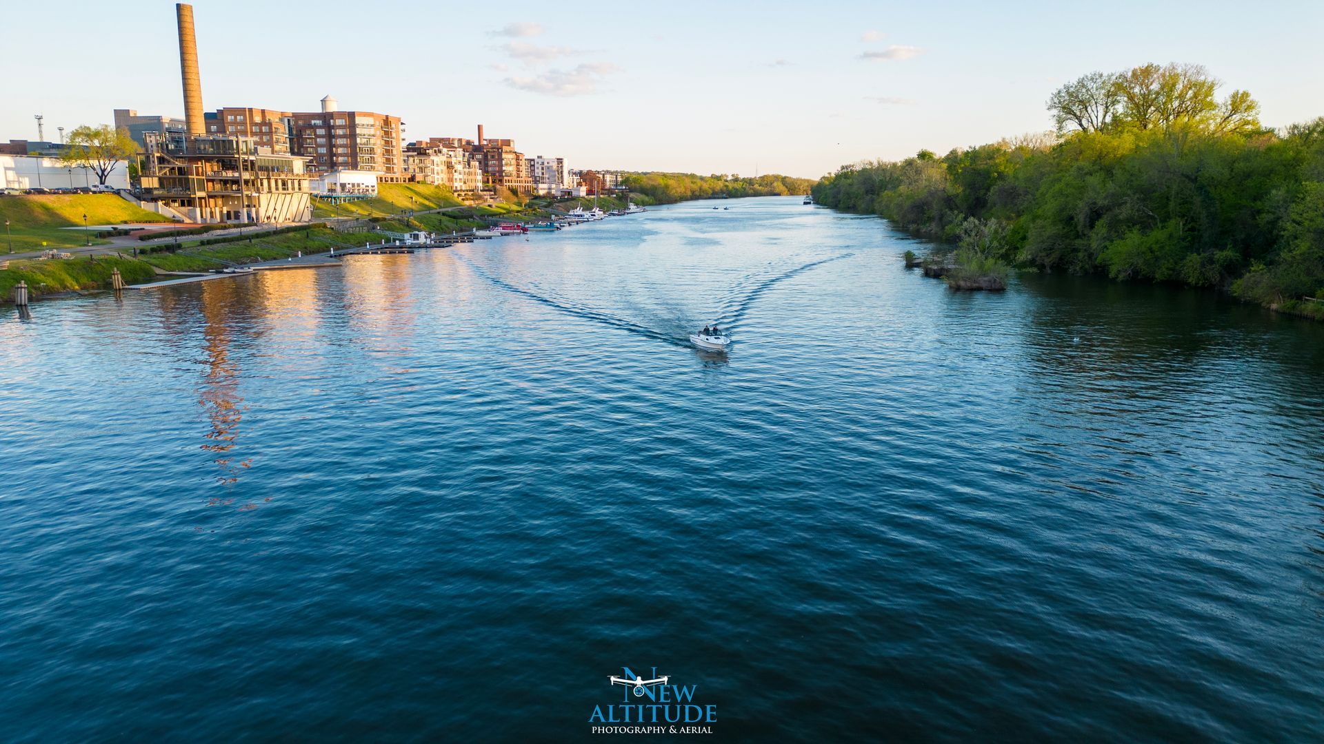
New Altitude Photography & Aerial proudly provides professional drone services throughout Richmond VA, Mechanicsville, Hanover County, Chesterfield, and Central Virginia. Our FAA Part 107 certified pilots specialize in construction progress reporting, aerial photography, real estate marketing imagery, and commercial drone services.
Trusted By Partners & Clients
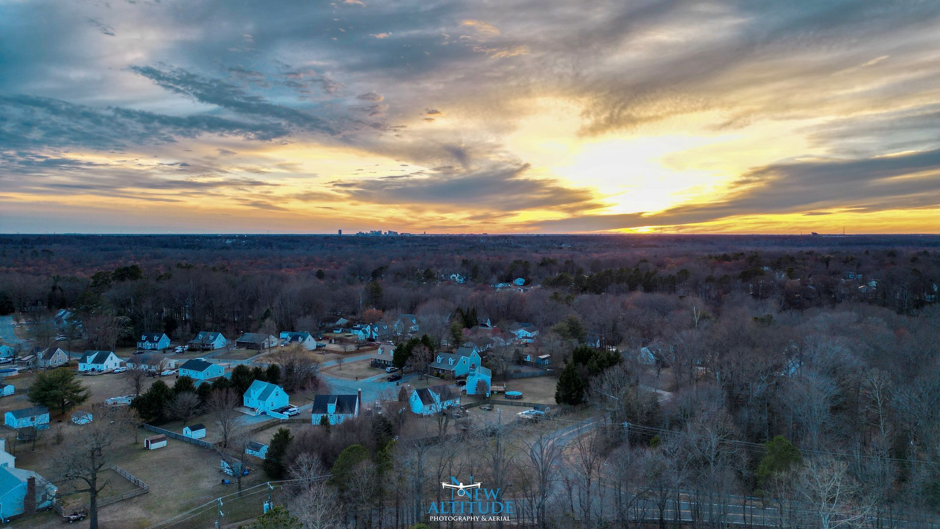
City skyline


Who We Serve
We proudly partner with commercial builders, engineering firms, local real estate professionals, and legal teams across Richmond, Virginia, Mechanicsville, Hanover County, Chesterfield, and surrounding Central Virginia communities. Our professional drone mapping services deliver highly accurate aerial maps, orthomosaic imagery, orthophotos, and detailed 3D models to support project planning, construction documentation, land development analysis, and legal case evidence.
Using advanced drone technology and FAA Part 107 certified operations, we provide reliable aerial data that helps streamline site planning, improve project oversight, and strengthen documentation for engineering reports and legal proceedings. Whether you need mapping, construction progress verification, or aerial documentation for litigation support in Richmond, VA, our team delivers clear, actionable visuals you can trust.
SERVING:
• Richmond VA
• Mechanicsville VA
• Hanover VA
• Ashland VA
• Chesterfield VA
• Henrico VA
Supporting real estate agents, brokers, developers, and property managers with high-quality aerial photos, videos, and marketing visuals that elevate any listing.
What We Do
Aerial Services Built For Your Project
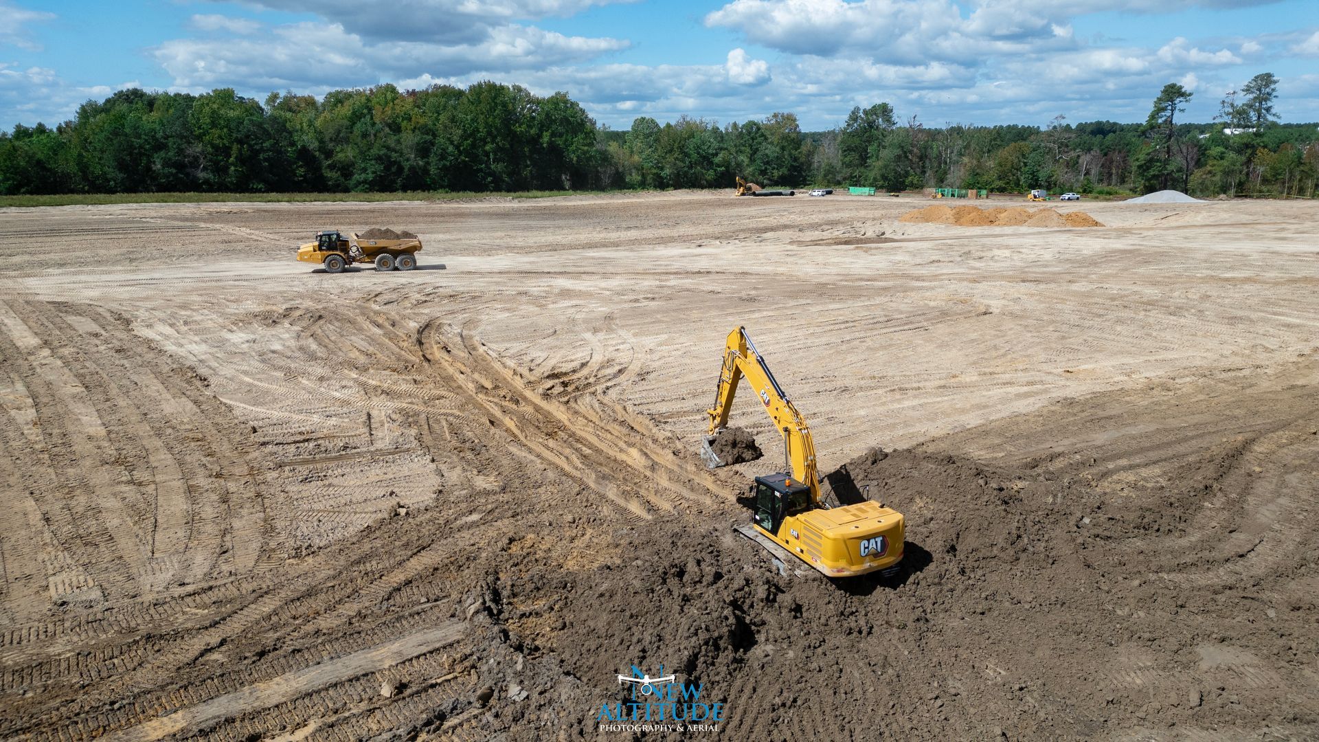
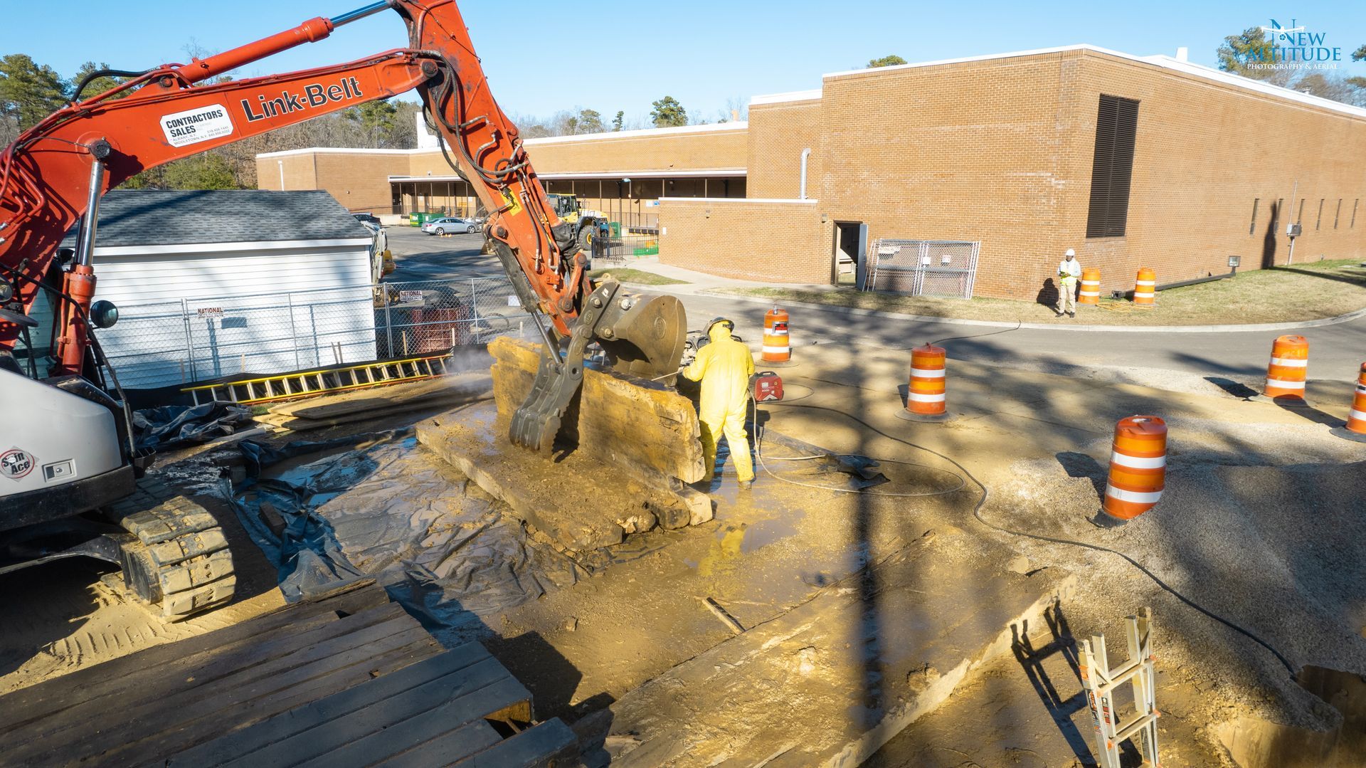
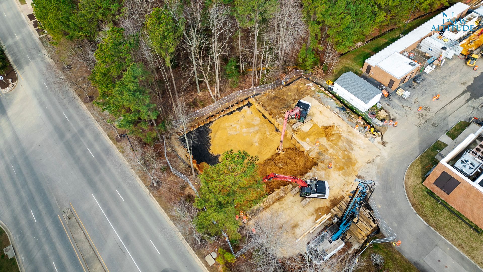
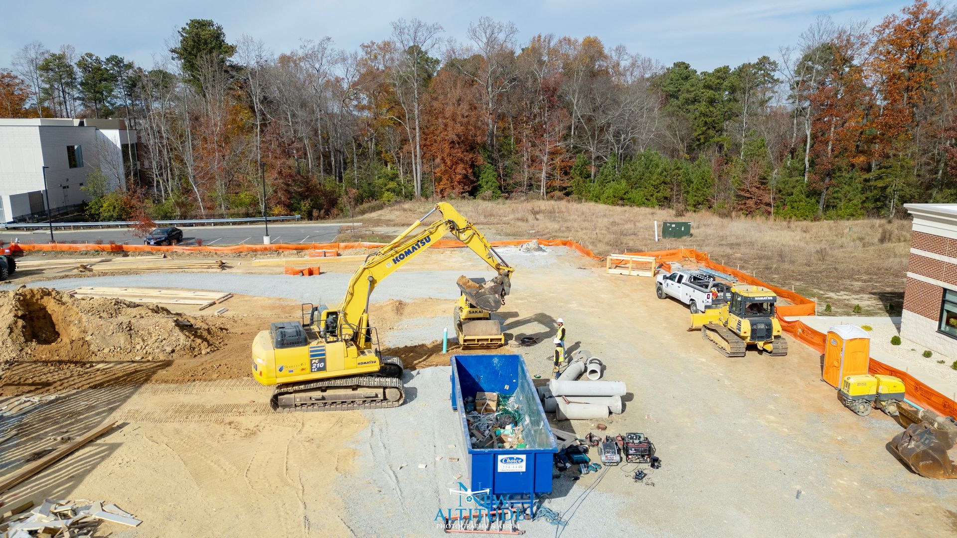
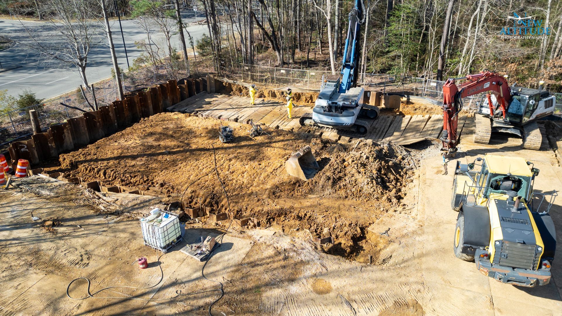
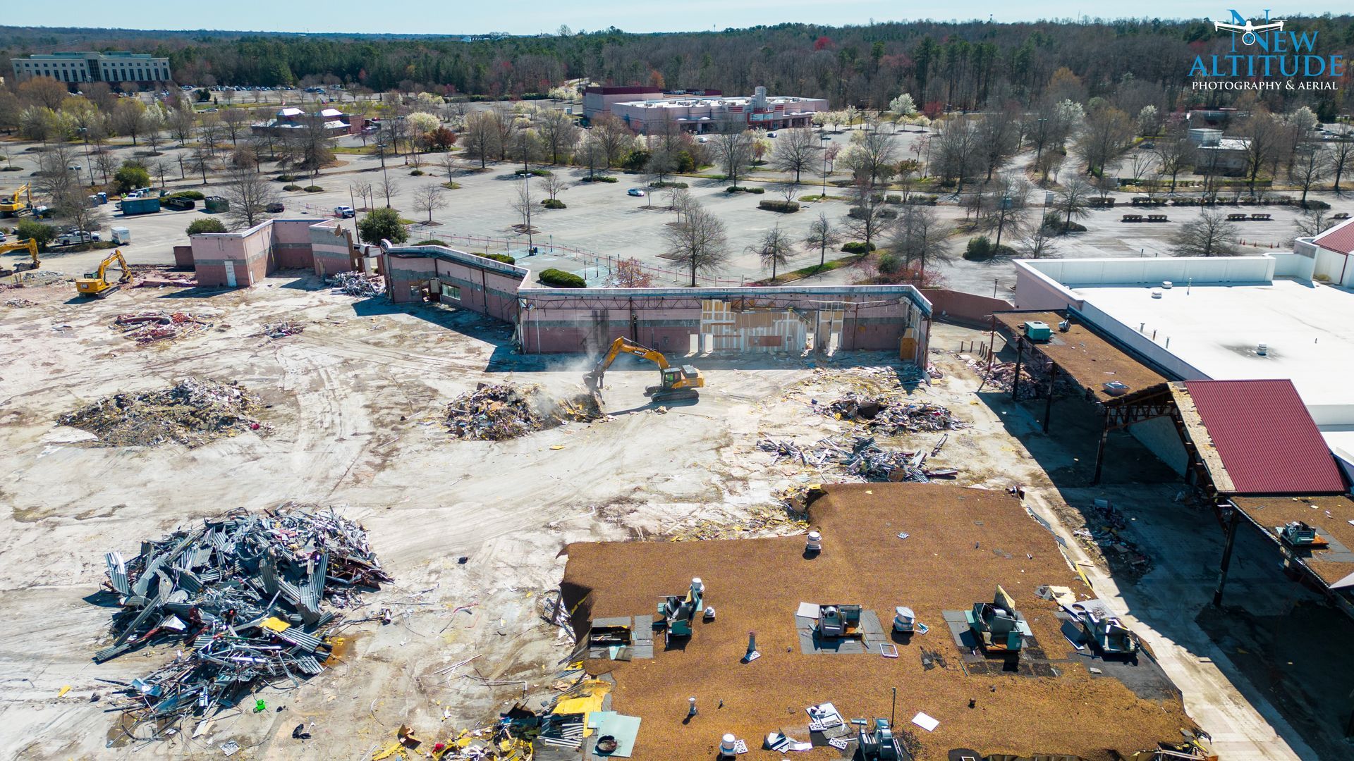
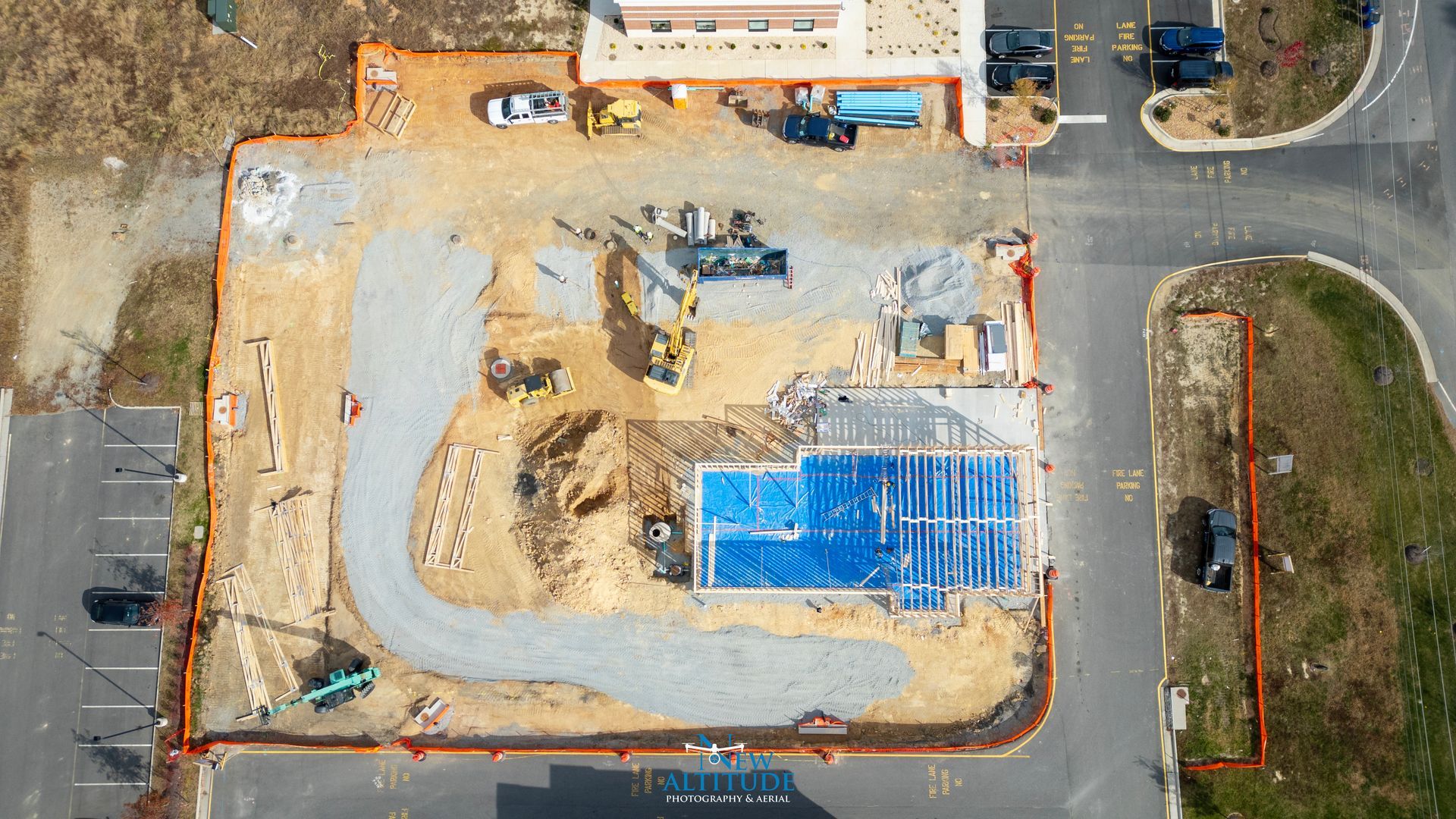
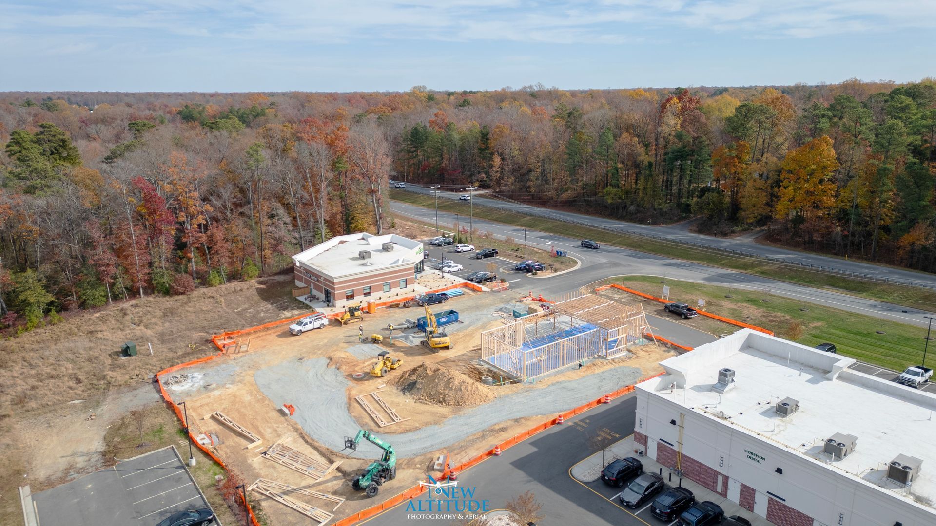
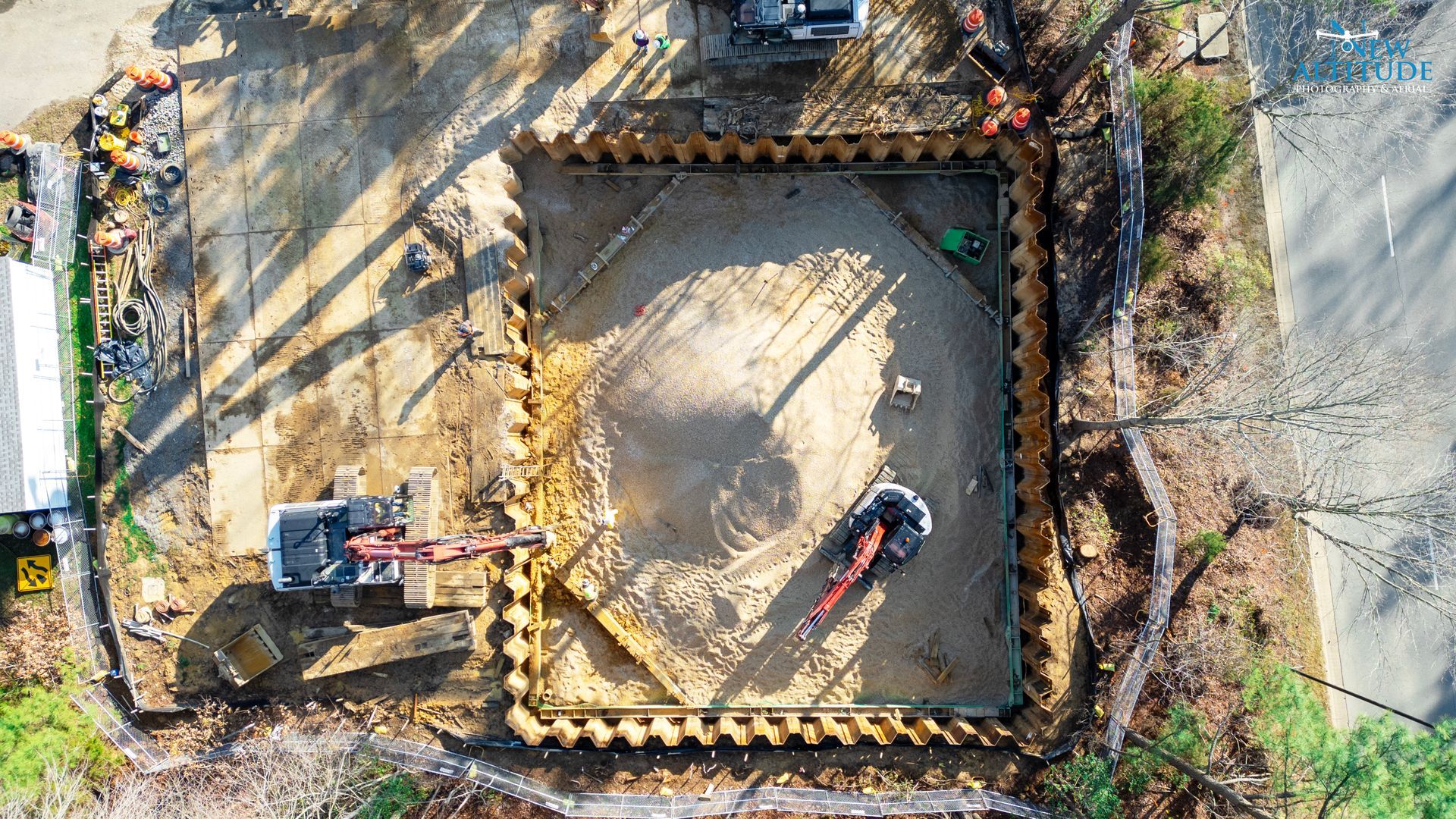
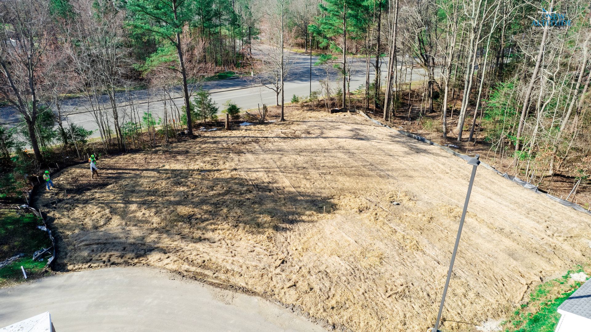
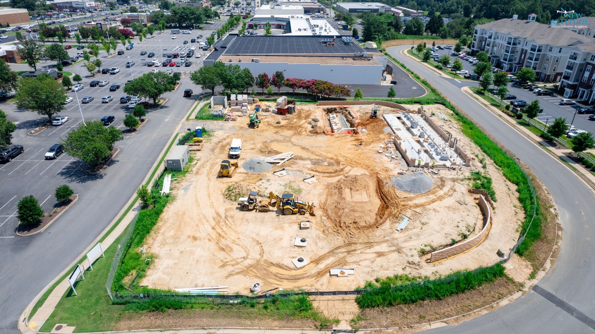
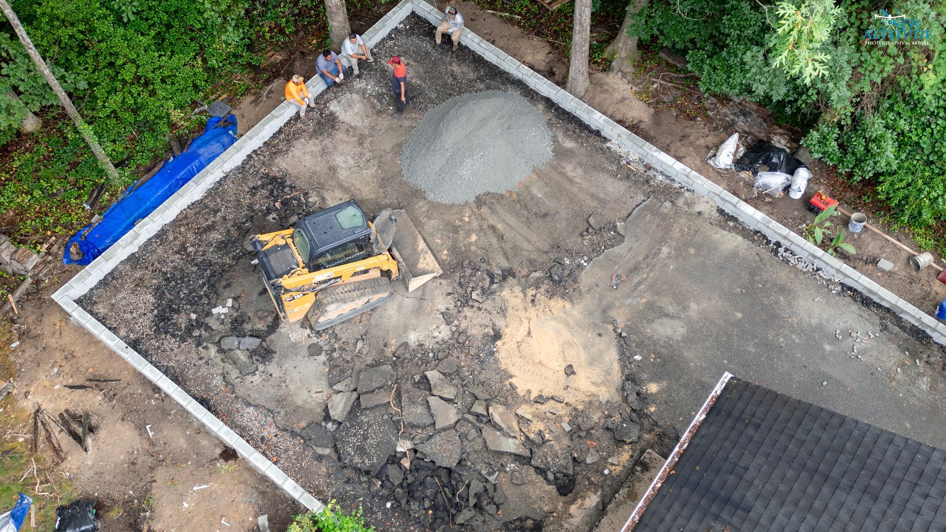
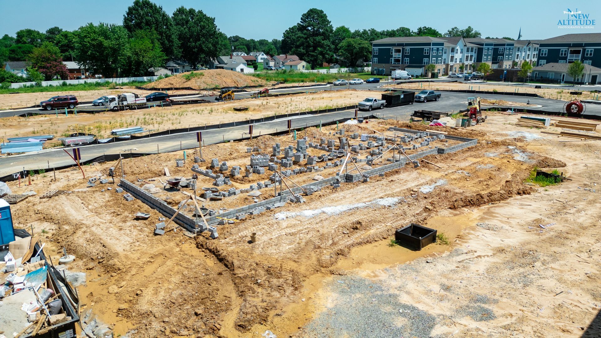
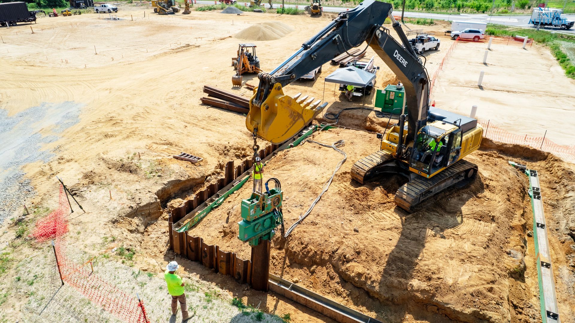
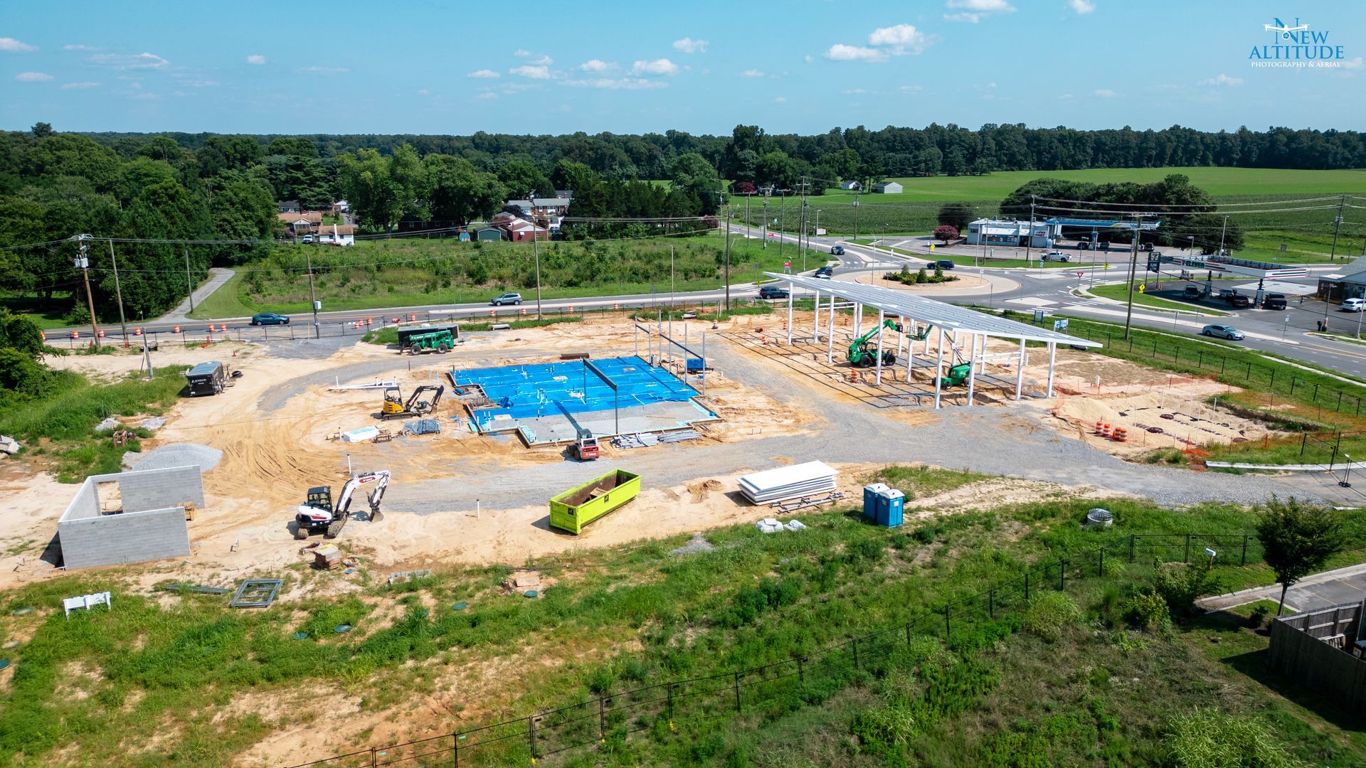
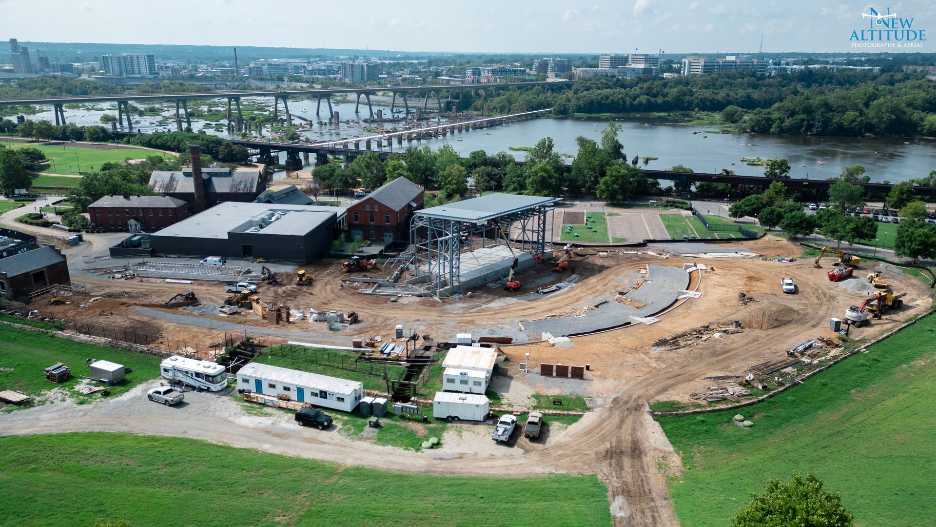
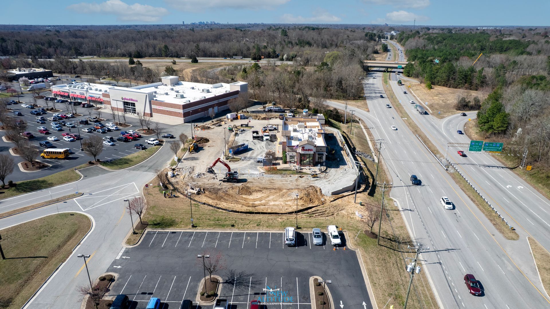
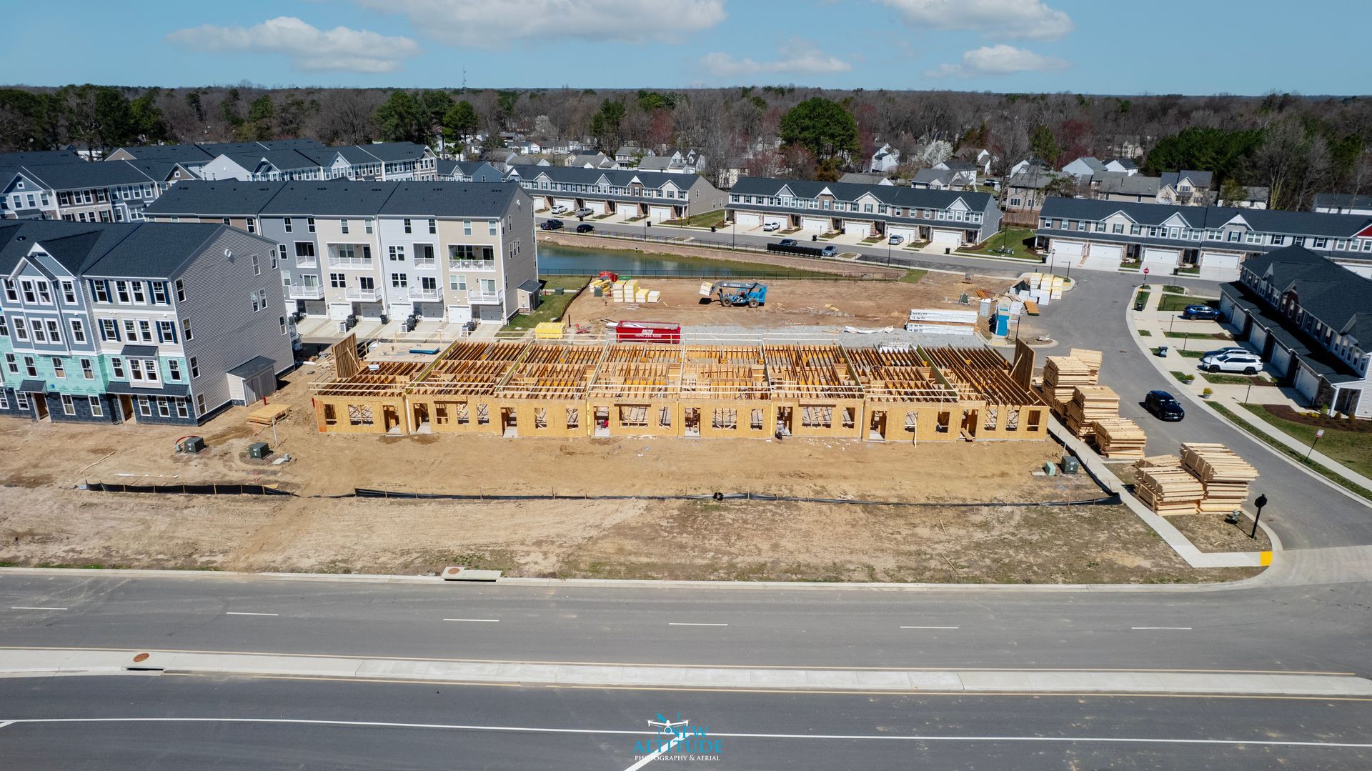
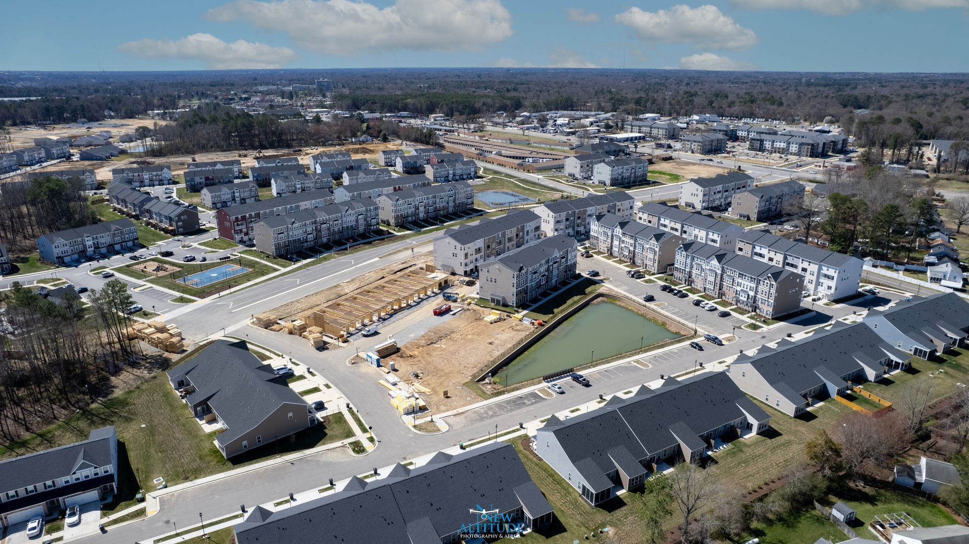
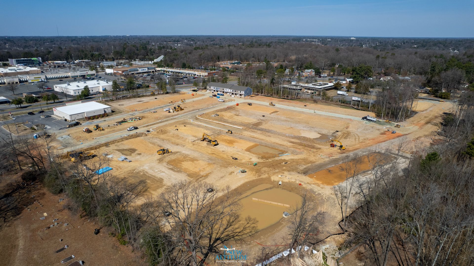
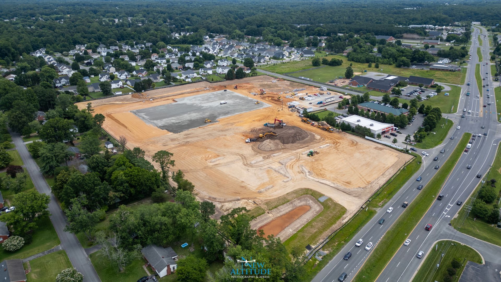
Construction Monitoring
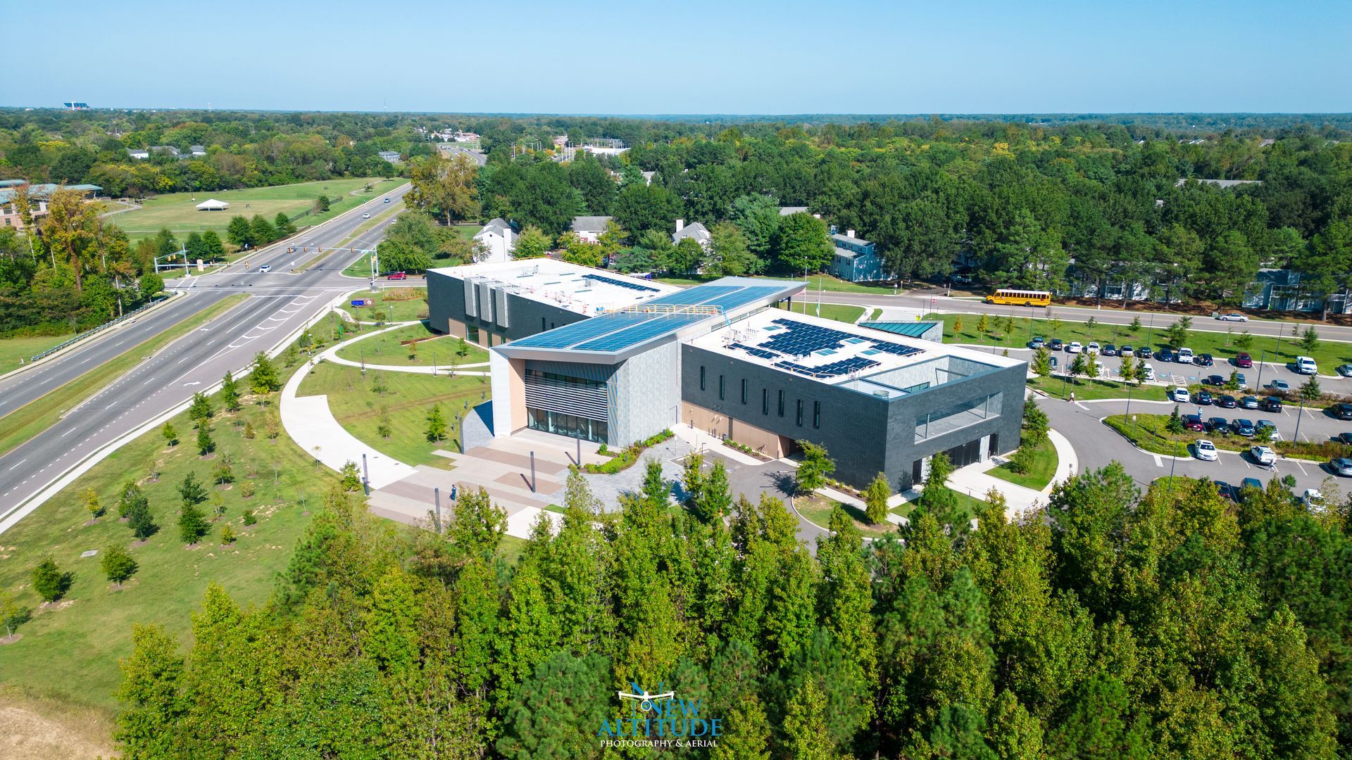
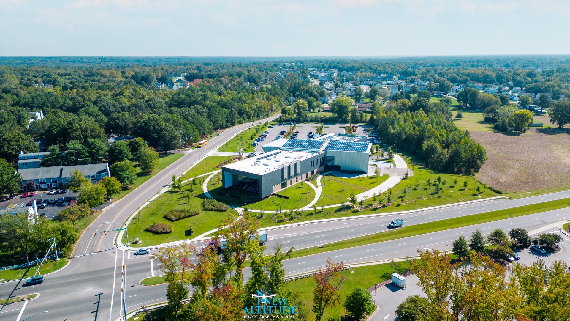
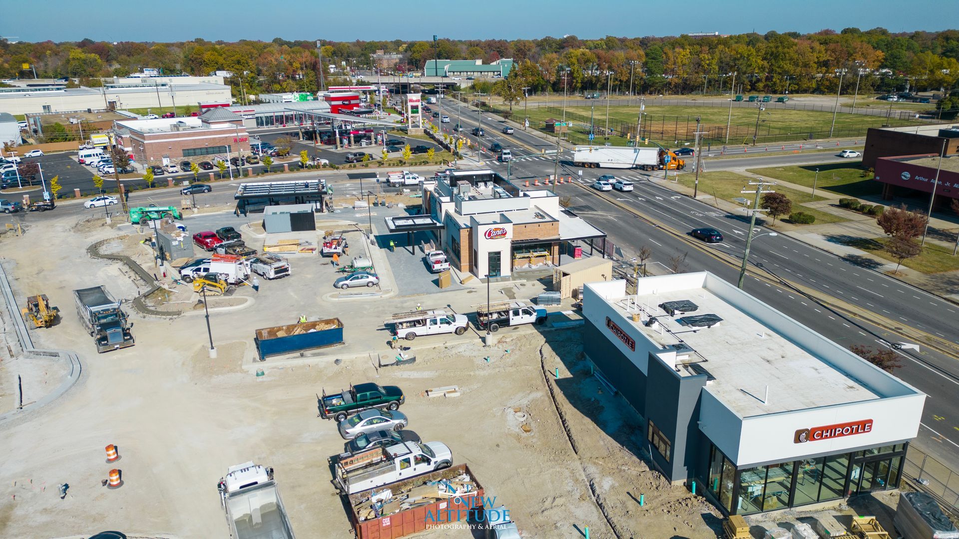
At New Altitude Photography & Aerial, we deliver high-quality aerial imagery and detailed mapping solutions designed to keep your construction projects on track. Our construction progress reporting provides consistent, up-to-date visuals that help project managers, developers, and stakeholders clearly monitor site evolution from start to finish
.
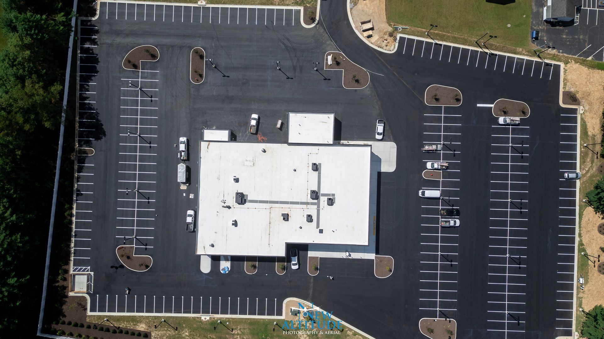
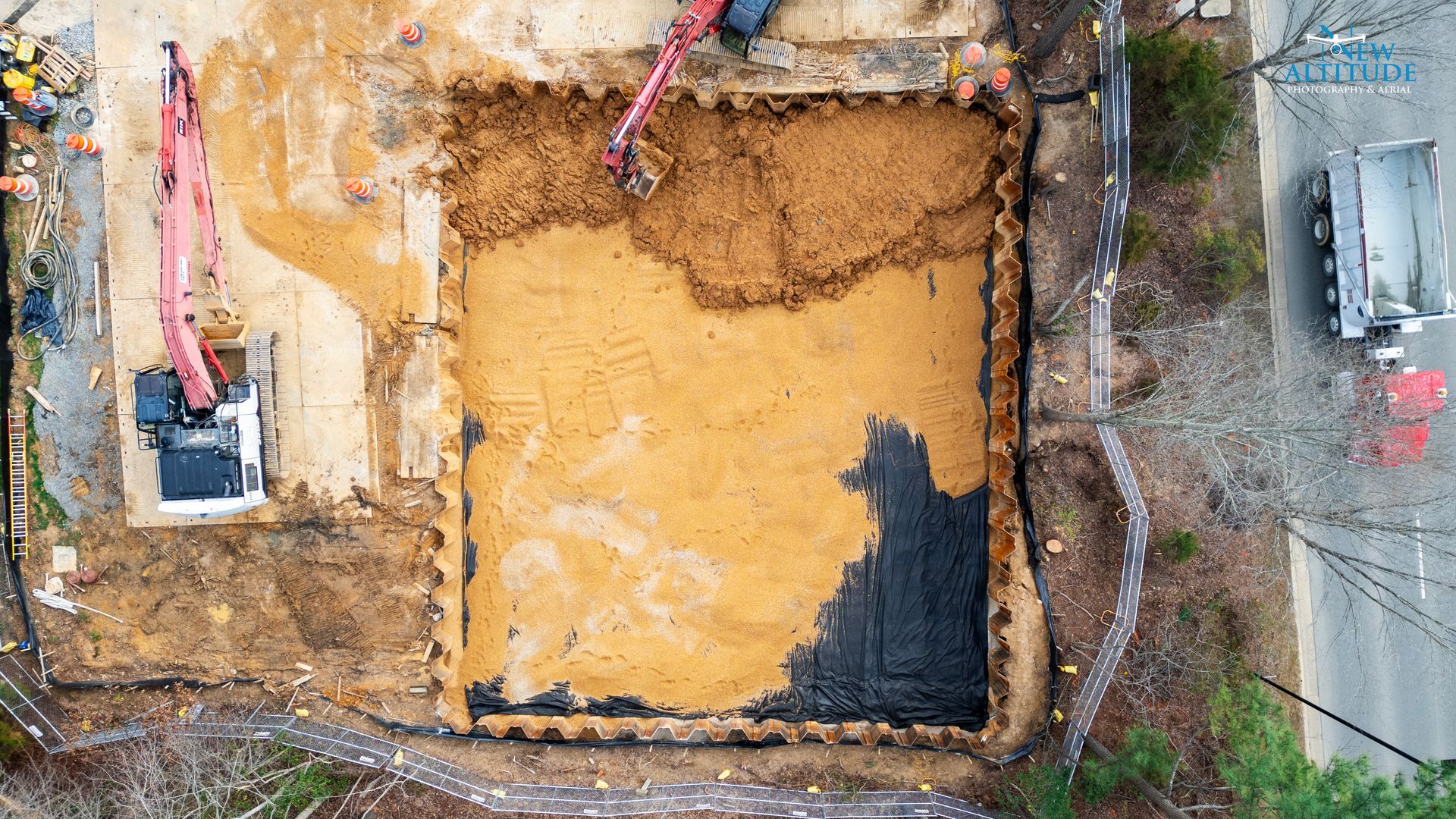
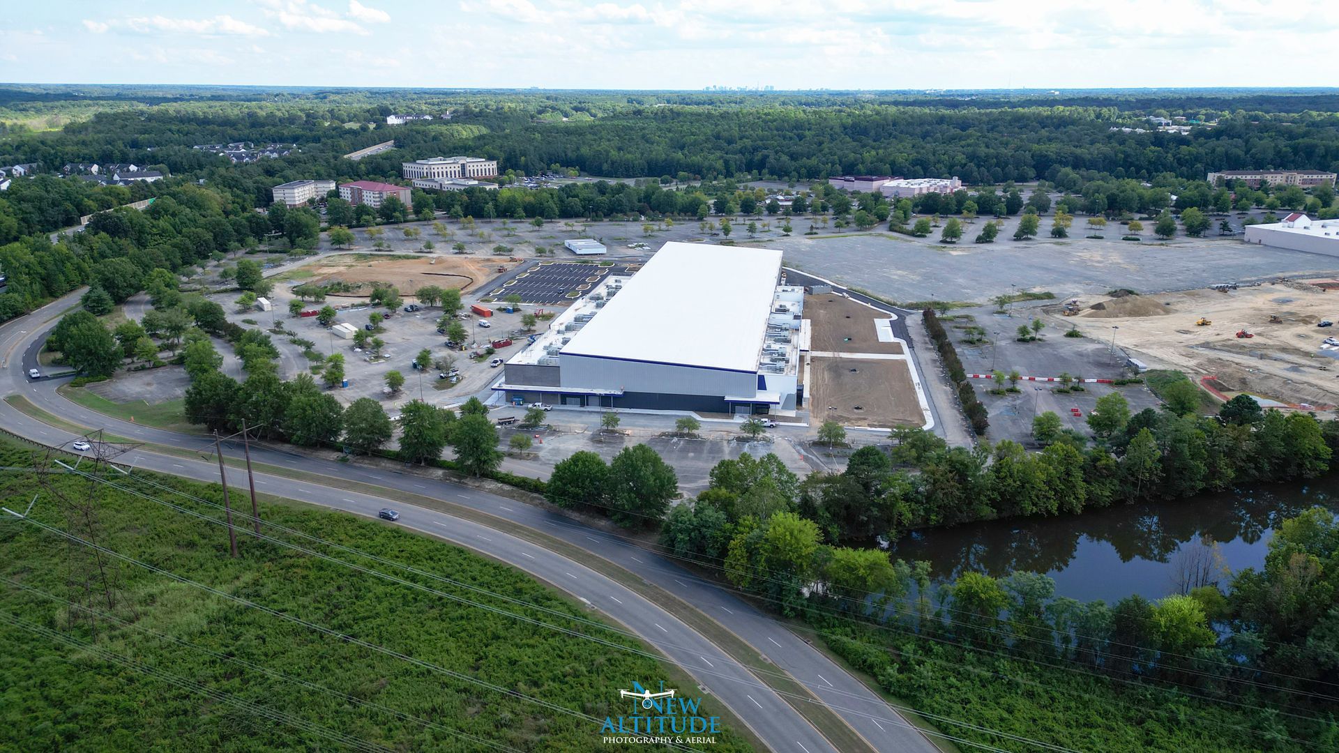
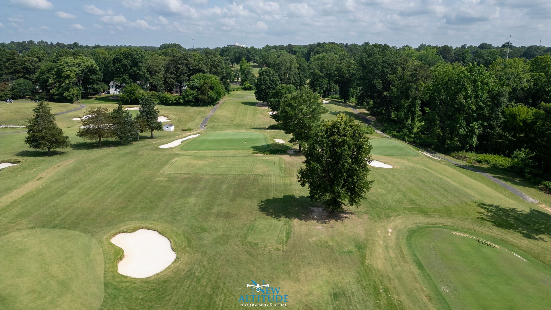
2D / 3D Mapping
New Altitude Photography & Aerial delivers precise 2D and 3D mapping solutions for construction projects of all sizes. Our high-resolution orthomosaic maps provide accurate, up-to-date visuals that support planning, measurement, progress tracking, and site documentation.
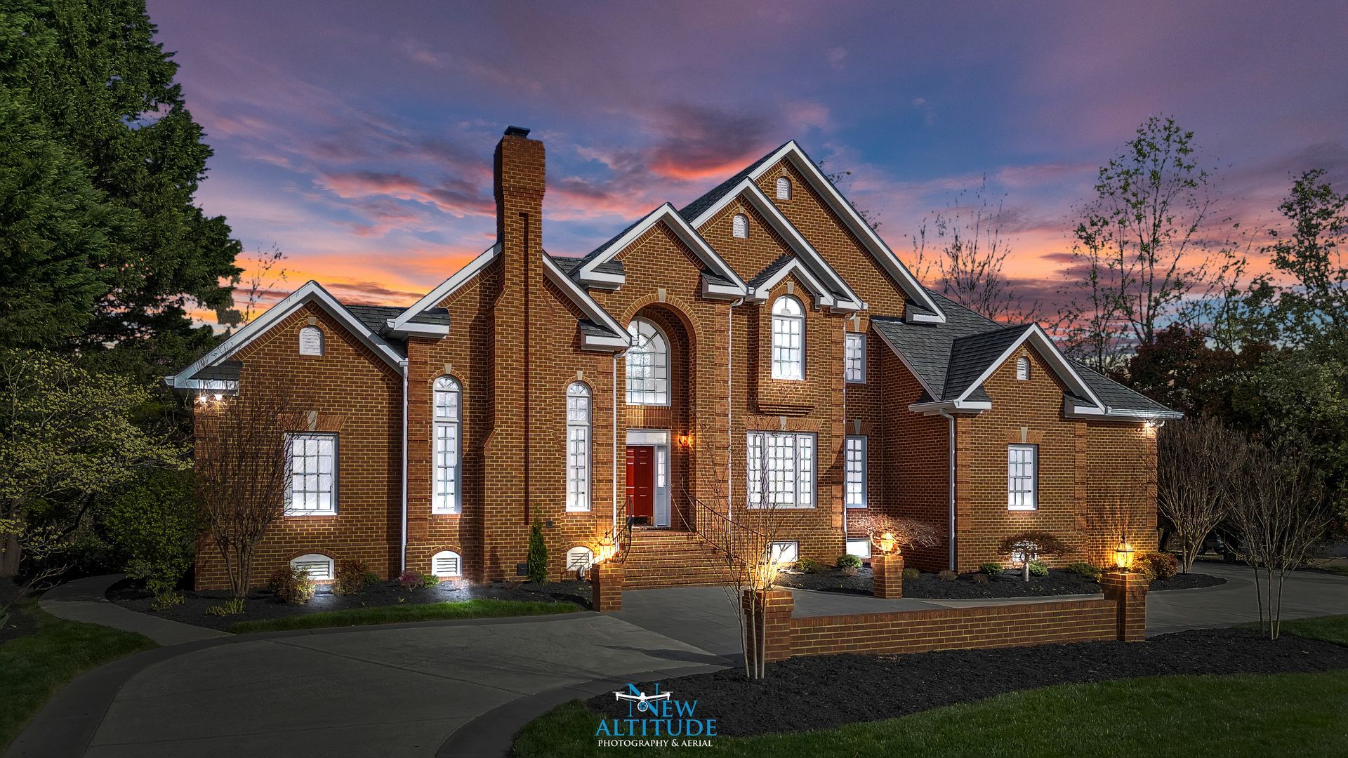
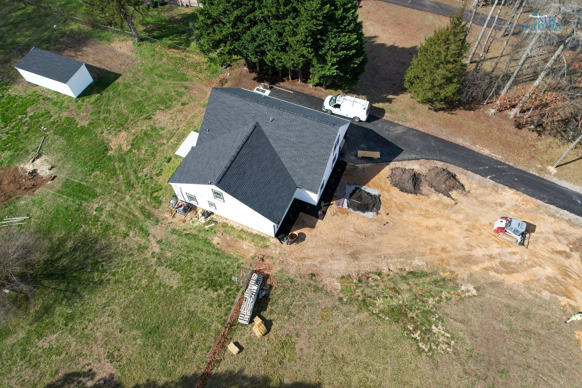
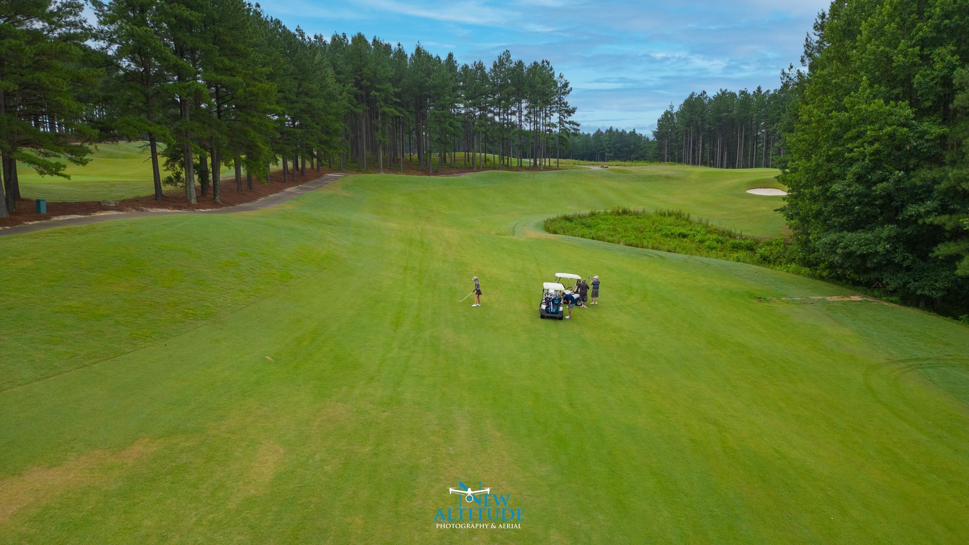
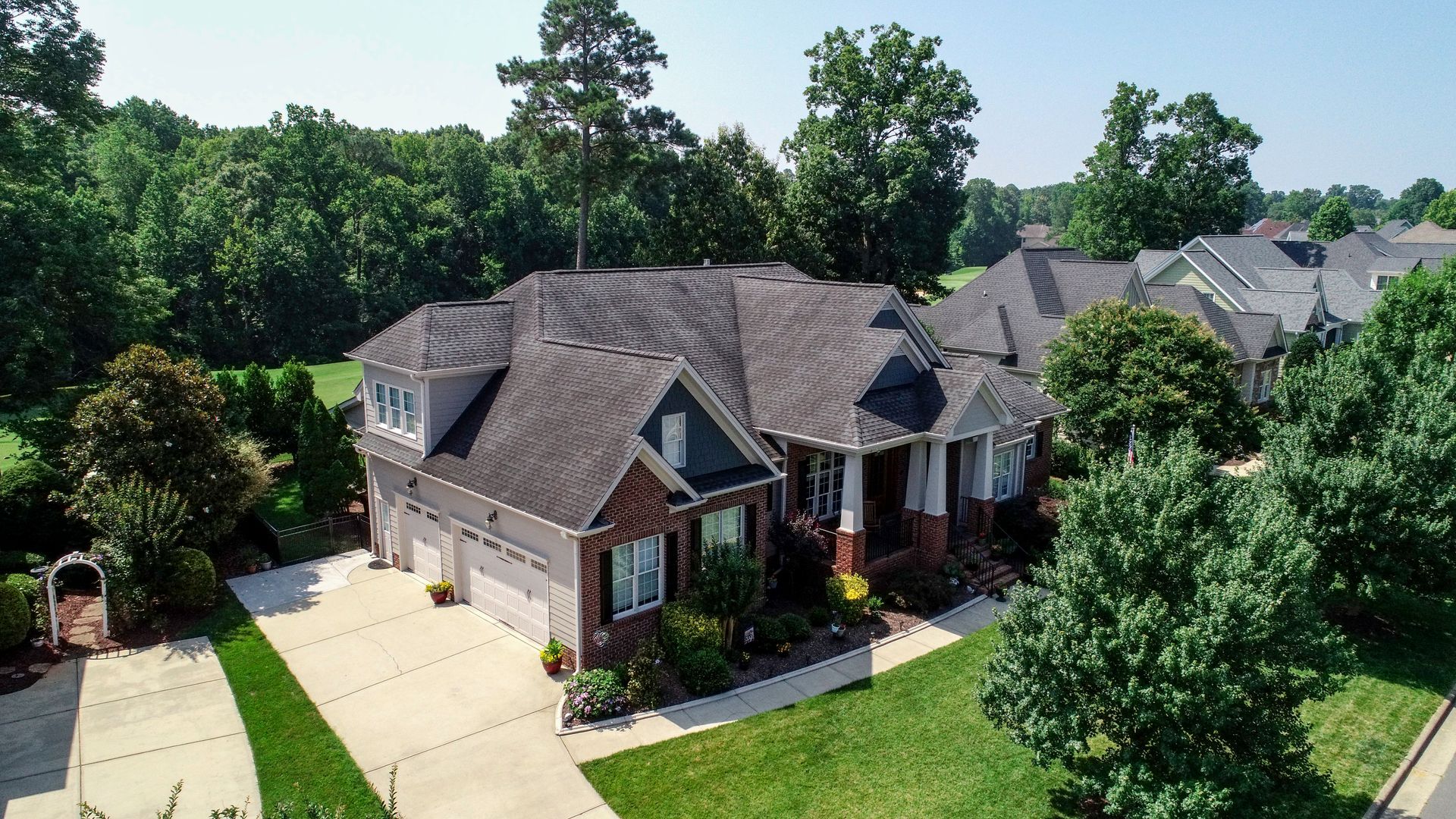
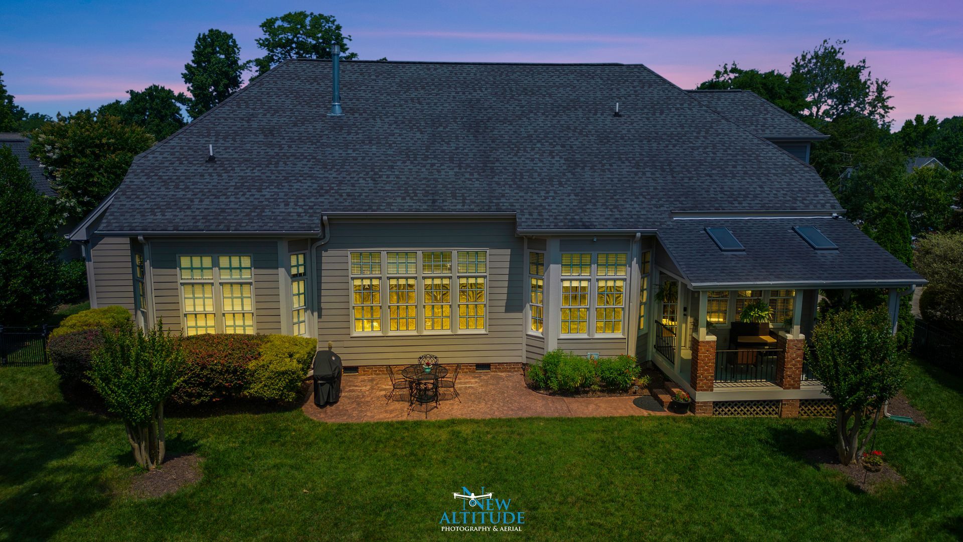
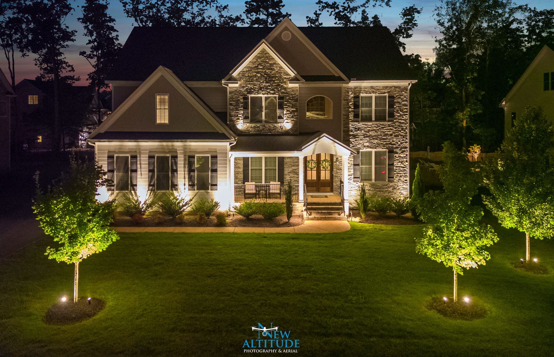
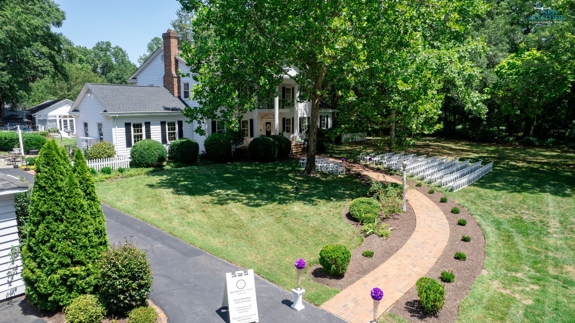
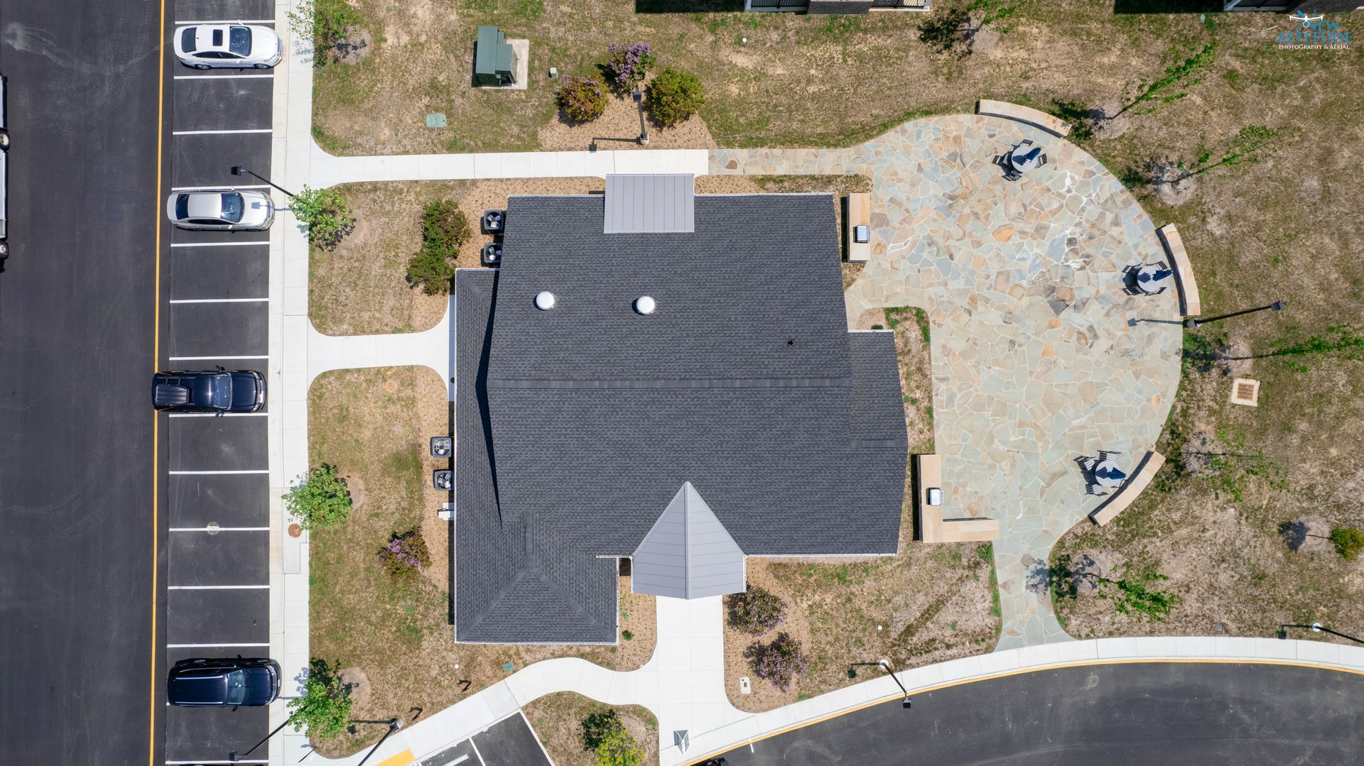
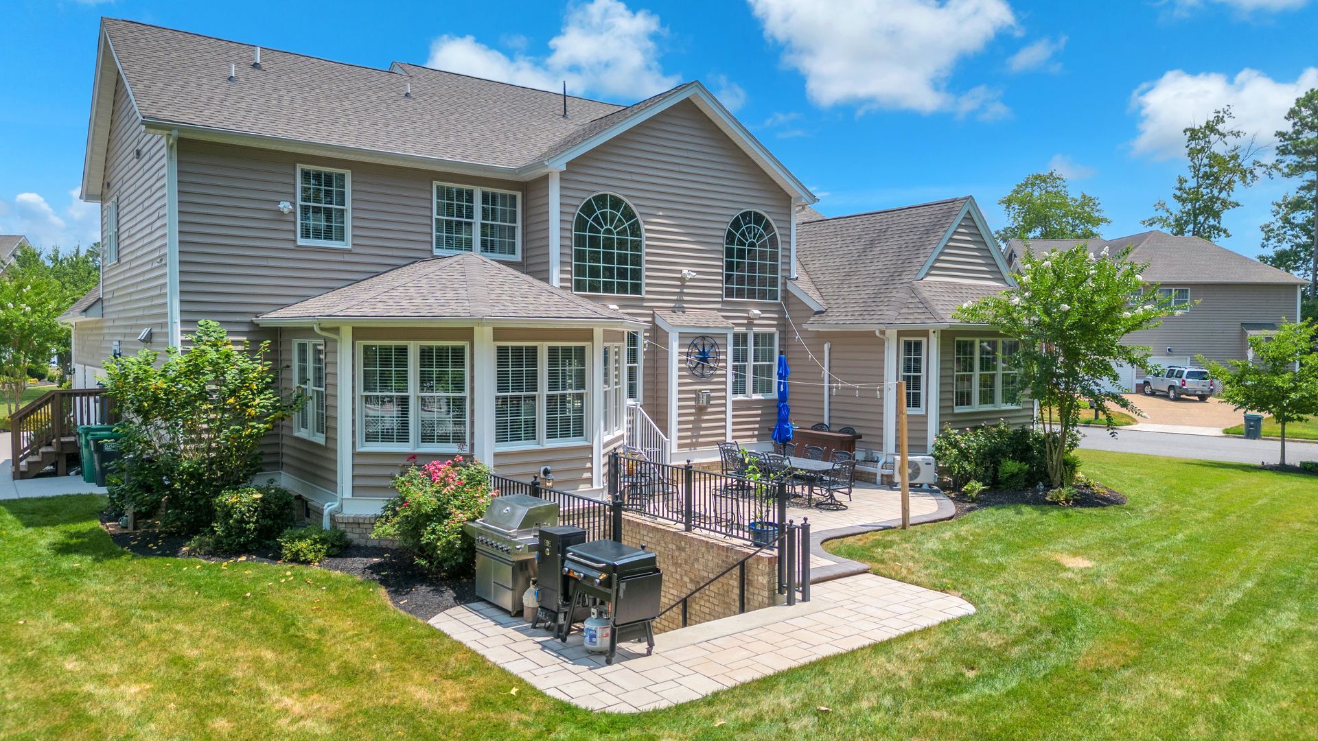
Residential Real Estate
Showcase your property with stunning, high-resolution aerial photos and video. New Altitude Photography & Aerial captures the full story of your listing — from lot layout and rooflines to nearby amenities and surrounding scenery. Our FAA-certified pilots deliver premium visuals that boost engagement, highlight property value.
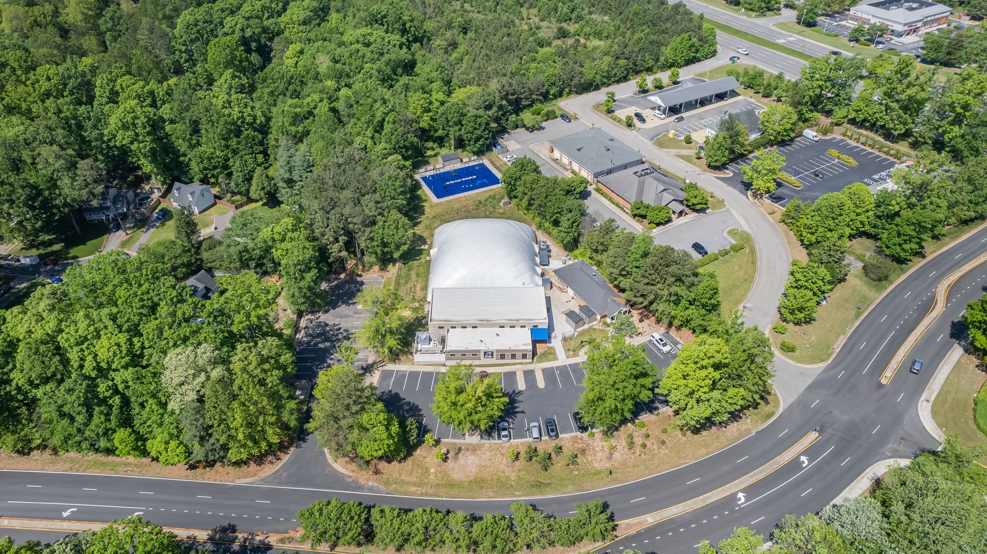
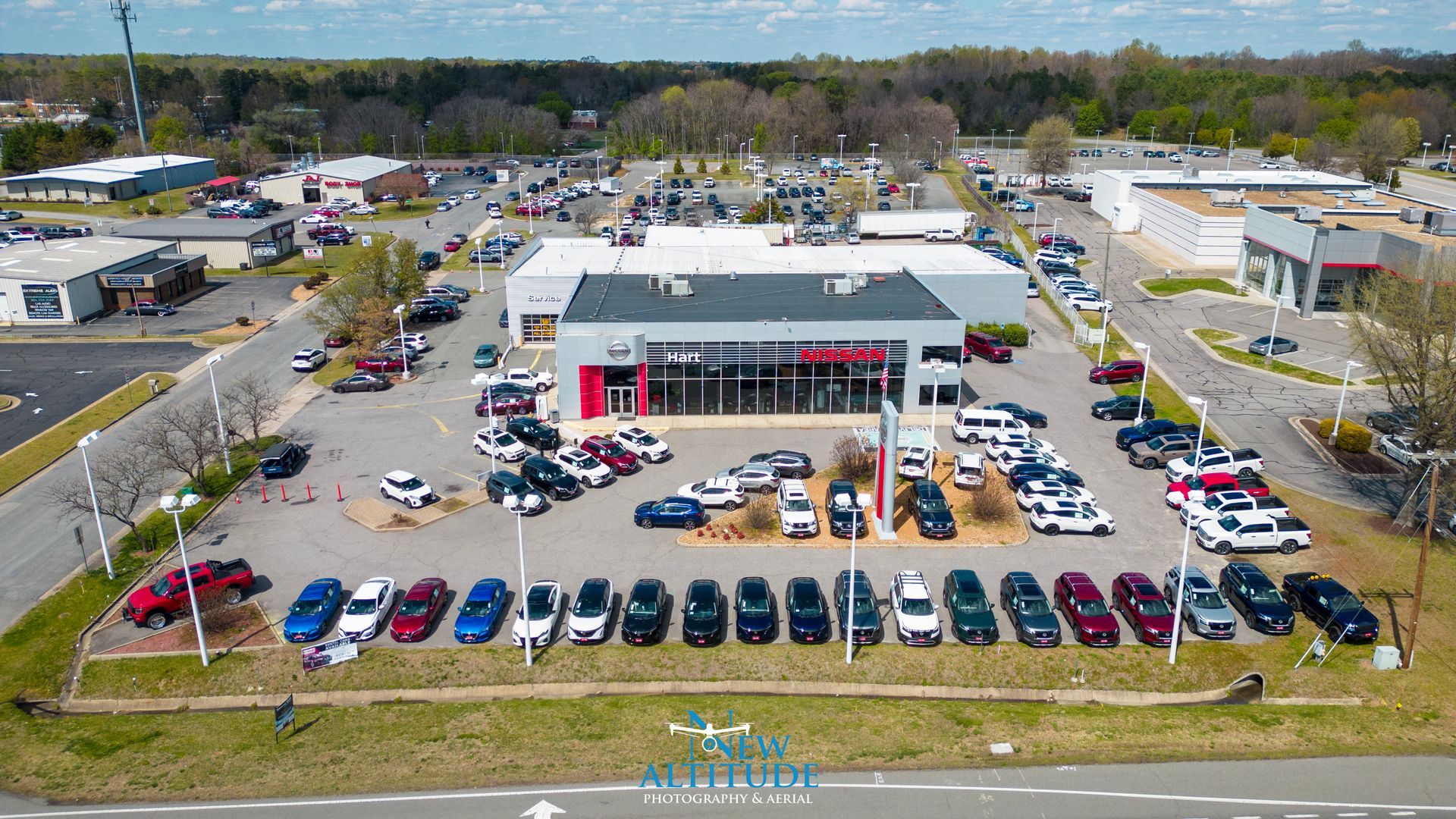
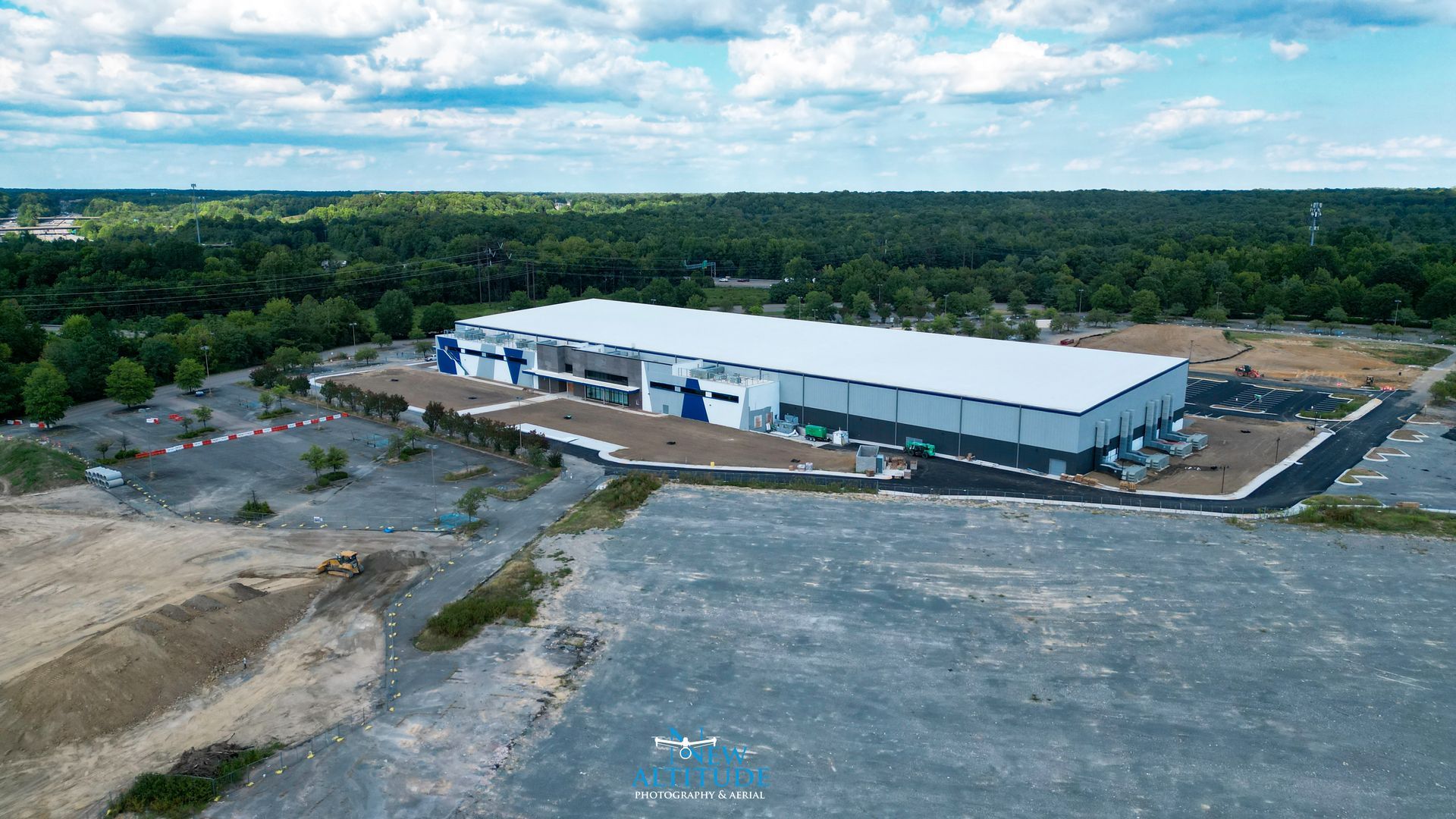
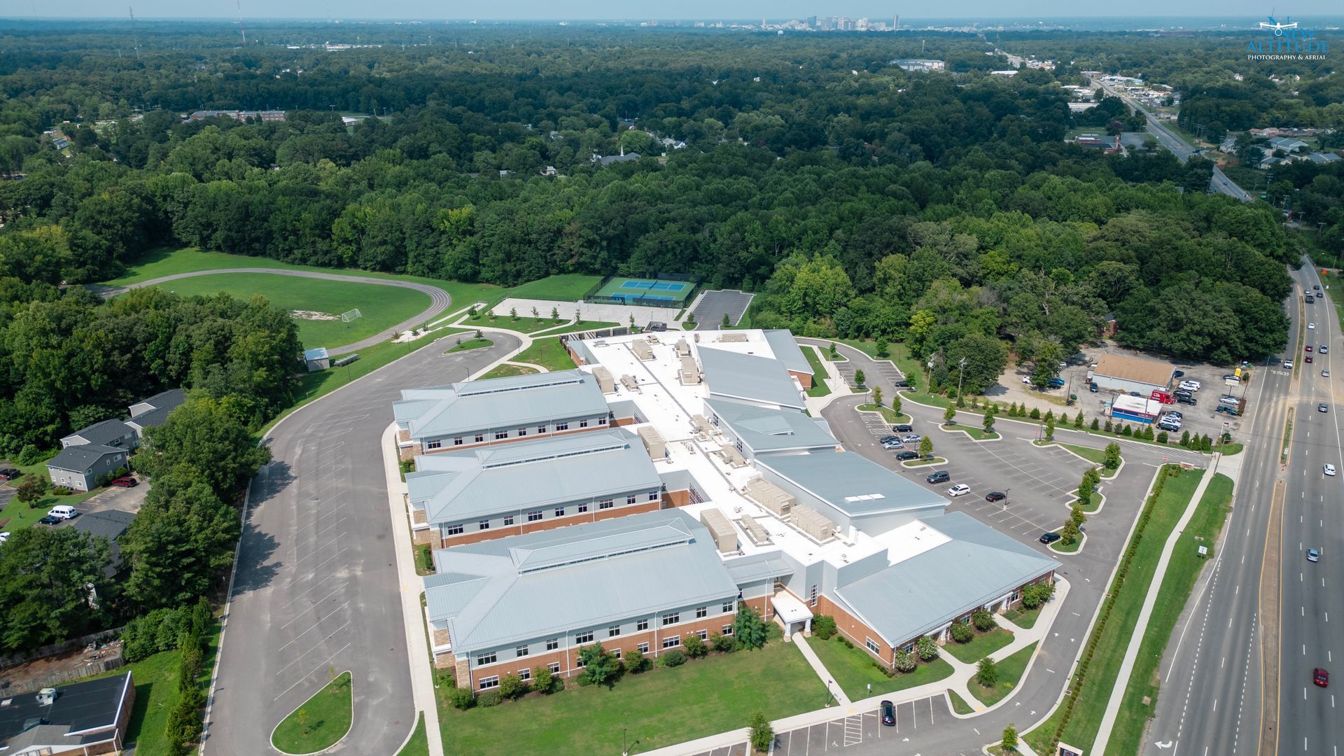
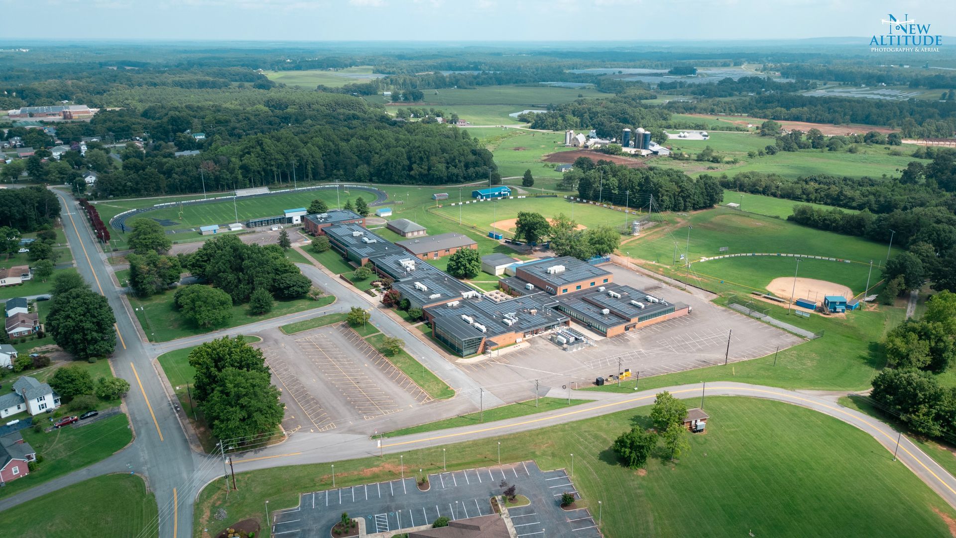
Commercial Real Estate
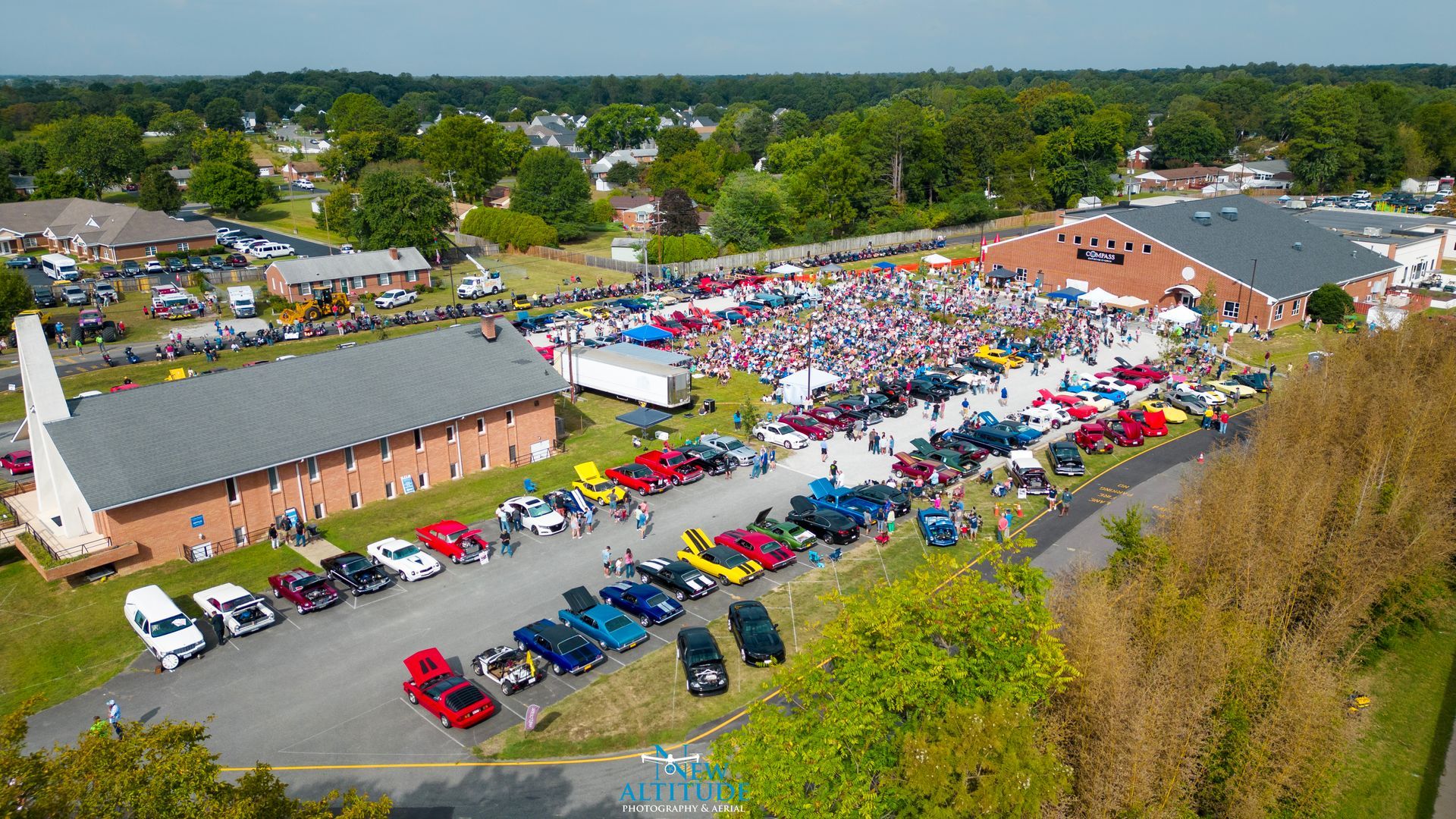
New Altitude Photography & Aerial delivers high-quality drone photos and videos that showcase commercial properties with clarity and impact. From large facilities and retail centers to multi-building complexes and land developments, our aerial media highlights scale, layout, and location in a way traditional photography can’t match.
About
New Altitude Photography & Aerial is a Richmond, Virginia-based drone services company providing professional aerial photography, drone videography, drone mapping, and construction progress reporting throughout Richmond, Mechanicsville, Hanover County, Henrico, Chesterfield, and surrounding Central Virginia communities. Our mission is to deliver reliable, high-quality aerial imagery that helps builders, real estate professionals, engineers, and businesses better document, market, and manage their projects.
Our passion for aerial imagery drives every project we complete. With careful attention to detail, we create professional drone photos, video, and mapping deliverables that become valuable long-term assets for your business. From construction progress documentation to real estate marketing and commercial site analysis, our aerial services provide clear perspectives that traditional photography cannot match.
As a trusted provider of drone services in Richmond, VA, we have extensive experience working with local contractors, developers, real estate agents, and property managers across the Richmond region. We specialize in cinematic drone videography, high-resolution aerial photography, and accurate drone mapping and 3D modeling solutions designed to support construction planning, inspections, land development, and property marketing.
New Altitude Photography & Aerial operates under FAA Part 107 certification and maintains strong working relationships with the FAA and local Virginia municipalities. We handle airspace authorizations, flight planning, and project logistics efficiently, ensuring safe and compliant drone operations throughout the Richmond area.
We simplify the permitting process and carefully plan each flight using professional-grade, industry-standard drone equipment. Our reliable aerial imaging services help clients reduce site visits, improve project communication, and maintain accurate visual documentation from start to finish.
Businesses searching for drone photography in Richmond VA, construction drone services in Richmond, or aerial photography near Richmond Virginia choose New Altitude Photography & Aerial for dependable service, consistent results, and professional aerial imagery that elevates every project.
“Precision You Can Trust—Results You Can See.”
Testimonials
cruz masonry
1 month ago
“Erick and the team at New Altitude did an outstanding job. The video recording quality was exceptional, and their professionalism and flexibility made the entire process incredibly smooth. They were a pleasure to work with from start to finish. Highly recommended!”
Justin L
2 months ago
Had a great and professional experience with Eric at New Altitude. My company had a complex project and New Altitude provided all the aerial photo and video support for the project. Eric and New Altitude had all the required certifications needed for this state of VA project and worked within tight timelines to help me meet project delivarables. I would absolutely work with Eric and New Altitude again. - Justin L.
2 months ago
Working with Eric was great. Responsive and always open to make the changes we requested, very professional and skilled photographer. We are very satisfied with the overall final product!
3 months ago
This company is FANTASTIC! I cannot provide a higher recommendation for your aerial photography needs. This company and its owner are responsive and prompt from start to finish and provide quality work.


Customer reviews

Daniel K.
"I honestly received the best service I could have asked for. They were super professional to deal with; they met all my needs and helped me a lot."

Ron H.
"The entire experience was so easy and friendly, and the price was very reasonable. I don't know what I would have done without them."

James F.
"I can't say enough good things about the quality of this company. Highly, highly recommend using them!"
Special features

Best quality
We guarantee your full satisfaction
Competitive pricing
The best value for money

Licensed professional
Fully qualified in our field

Prompt service
The fastest service, directly to your doorstep
Contact us
Follow
Contact us
We're here to help! Send any questions you have over to us. We look forward to hearing from you.
Ready to Elevate Your Construction Documentation or Real Estate Project?
Whether you’re looking for a detailed quote, need guidance on an upcoming project, or simply want to learn more about our aerial mapping and documentation services, our team is here and ready to assist.